
Nor'easter latest: high wind warning expires; missing swimmer found alive

People on kayaks make their way down a flooded West Lake Drive in Lindenhurst on Sunday. Credit: Newsday/James Carbone
A powerful nor'easter that battered Long Island on Saturday had slowed, but not abated, by Sunday afternoon. For the latest information, click here.
Police: Missing swimmer called authorities to report he was fine
The unidentified swimmer whose reported disappearance Saturday led to an hours-long search involving local, state and national agencies was not in the water for long, according to police.
"He was only in the water for a short period of time, going for a swim," State Trooper Brittany Burton told Newsday.
The search was triggered by a 911 call around 2:30 p.m. of regarding a white man in dark shorts who did not reappear after he was seen going into the water in the Field #3 area of Robert Moses State Park, she said.
Read full story here.
Blakeman: Nassau 'gotten through the worst' of the storm
Nassau County Executive Bruce Blakeman said during a press conference Sunday afternoon in Mineola that there should be more coastal flooding around 9 p.m. due to high tide, but that the area had "gotten through the worst" of the storm.
"We don't expect to lose too much more power in the homes, unless we have down trees," Blakeman said. "This was extremely difficult. It was a tough storm, especially with the sustained winds, the high tide, and of course, the full moon didn’t help."
Blakeman said that the Long Island Rail Road is "on, or close, to schedule" and that NICE Bus is "moving a lot smoother."
"I think our road closures are down to minimal," he said. "It’s been cleaned out pretty good."
18,000 still powerless on Long Island
Some 18,000 PSEG Long Island customers are still without power from the storm, but the utility says its crews have made headway, according to a release sent out at noon.
The company says more than 1,000 people have fanned across Long Island, working 16-hour shifts to bring back the juice to those impacted. So far, they've brought power back online for nearly 94,000 customers.
Timing on when power will be fully restored to everyone is subject to change, according to the utility.
Surfers defy warnings, hang ten off Long Beach

Gnarly. Electric. Sick. Dope.
Four words used by the four musketeers of Holtsville to describe Sunday morning’s surf.
Micah Steezington, 20, Tanner Klein, 23, Alex Scichilone, 22 and Brian Moir, 22 left their homes at 7 a.m. for another day of nor’easter surfing in Long Beach.
Gov. Kathy Hochul warned New Yorkers to stay out of the water this weekend. But storm waves are what dreams are made of for surfers.
“The summer was awful,” Moir said with a pout.
The Long Beach boardwalk was all but empty on Sunday morning as surfers peppered the ocean.
One man emerging from the water spotted his friend.
“It was gnarly, dude!” he shouted.
Missing swimmer found alive, unhurt
The man who was thought to be missing after swimming in Robert Moses State Park Saturday afternoon has been found safe, the New York State Police reported Sunday morning.
Multiple state and local agencies, including state police and the state parks police, the West Islip Fire Department, Babylon Public Safety Department and the U.S. Coast Guard, searched for the man Saturday. The search was suspended Saturday night.
The man, who was not identified by the authorities, was seen entering the water by field 3, but was not seen leaving, police said.
After broad news coverage of his apparent disappearance, the man contacted the police to let them know he was unharmed.
The man's whereabouts were unknown for almost 20 hours.
Further details were not immediately available.
Two roadways closed on North Shore in Nassau
Roads closed Nassau County issued an advisory Sunday to motorists that all lanes of Middle Neck Road between Picadilly Road and Wooleys Lane in Great Neck were closed due to a tree and utility pole down.
Drivers were advised to use an alternate route.
Nearby, a fallen tree on NY 107 in Sea Cliff has closed all lanes in both directions at Glen Head Road.
The latest report was one of several downed trees and power lines across Nassau and Suffolk counties.
One family's story: 'What am I going to lose?'

The Pace family story was like many others. After getting priced out of their hometown of Flatbush, Brooklyn, they left in 2021 with their 1-year-old daughter and dreams of affording a decent home in the suburbs.
But five years later, the house they purchased in Freeport has left them wading knee-deep in water with skyrocketing insurance bills.
"We're suffering," said April Pace, 44. "We lost our car in our first year. We lost our deck. Every year we're trying to figure out, 'What am I going to lose this year?'"
Pace and her husband, Ford, prepared early for the nor'easter. They parked their car four blocks inland on Atlantic Avenue in a parking lot and bought a wet vac to clean up water in the home. Ford's elderly mother lives on the first floor.
"Water was shooting out of the sink. It was coming through the stairs, through the foundation of the house," Pace said.
When the Pace couple bought their home on South Ocean Ave. five years ago, their flood insurance was $950, she said. Now, it's $3,000.
Every spring, officials repave Freeport's Nautical Mile just a stone's throw away, Pace said. But they haven't touched the quiet block on South Ocean Avenue that has prompted several neighbors to move away since Pace bought her home.
Early Sunday morning, Pace watched as a neighbor kayaked from one end of the block to another. Still, even with a small lake out front and a flooded backyard, she says she won't consider moving.
"This is my home. God gave this to me. If it means I need to do things to fight for the village of Freeport to do more, then they need to do it," she said.
PSEG deployed 850 workers across Long Island
About 23,000 customers were without power as of 9 a.m. Sunday, according to PSEG. Power had been restored to more than 82,000 households who had lost power since Friday morning. Suffolk County experienced more outages than Nassau.
The utility said heavy winds had downed hundreds of trees and large branches, knocking out electrical poles and wires. It said more than 850 PSEG line workers, tree trimmers and others had been deployed to help restore power.
Residents were reminded to steer clear of downed electrical wires and flooded areas, in case there are submerged wires.
Crews are working 16-hour shifts and will continue until all outages are restored, the utility said. More than 700 trees and 440 large branches took down utility poles and electric wires, the utility said.
Latest forecast: Storm issues to continue into Monday

A woman wades through flooded West Lake Drive in Lindenhurst on Sunday. Credit: Newsday/James Carbone
The storm’s high winds and coastal flooding are expected to linger through Monday, according to an updated forecast and advisories the NWS issued at Sunday morning.
Gusts could reach 60 to 65 m.p.h. in some places, although most top speeds will be recorded around 45-55 m.p.h.
An additional 1 to 3 inches of rain is likely.
The NWS also warned of coastal flooding, especially during high tide Sunday afternoon, which could bring as much as 2 ½ to 3 feet of inundation, "particularly for communities along the southern and eastern bays of Long Island.”
Yankees, major sporting events impacted by storm
The storm upended the weekend’s professional sports schedules, as events were either cancelled or rescheduled.
Sunday's Yankees game against the Baltimore Orioles at Yankee Stadium in the Bronx was moved to 1:05 p.m. in an attempt to avoid rain. Gates will open at noon, according to the MLB website.
Saturday’s game had been rescheduled as a Friday double-header to avoid a Saturday rainout.
Races at the newly re-opened Belmont Park in Elmont were cancelled Saturday and Sunday. The new racing facility only reopened last weekend.
The New Yok Giants were scheduled to play the Tennessee Titans at 1 p.m. at MetLife Stadium in East Rutherford, New Jersey.
The New York Mets are scheduled to play their last game of the season Sunday in Washington, D.C., against the Nationals. First pitch is 1:05 p.m.
The New York Jets are in Detroit against the Lions at 1 p.m.
New reports of downed trees, lane closures
Shortly before 7 a.m., multiple downed trees were reported along the Nassau-Suffolk line.
A fallen tree on the Northern State Parkway eastbound near Exit 42S - Deer Park Road; NY 231 shut down one of the two lanes, according the 511NY.
A downed tree on NY 25A closed all lanes in both directions at Centerport Road and Little Neck Road in Huntington, the website said.
Another downed tree on NY 25A closed all lanes in both directions between Washington Drive and Woodruff Court; Old Northport Road in Huntington.
These reports are in addition to a downed tree closing two northbound lanes on the Seaford-Oyster Bay Expressway in Bethpage and another in Massapequa on NY 107 northbound at Commonwealth Avenue that closed the right lane.
Minor delays reported at region's airports
The nor'easter that prompted thousands of flight delays and hundreds of cancellations nationwide on Saturday left the region’s airports mostly in the clear by Sunday.
Very few flight delays and cancellations were reported on Sunday morning at John F. Kennedy, LaGuardia, Long Island MacArthur in Islip and Newark Liberty airports, according to the website FlightAware.
Travelers will likely have more luck than on Saturday, when airlines cancelled 17 flights from JFK and all Cape Air trips from MacArthur Airport to Boston.
No injuries or significant damage reported; trees down in Nassau
As of Sunday morning, Long Island police reported the storm had not caused any injuries or significant property damage.
Suffolk police said they’d received many calls about downed branches and trees in many different locations, but no reports of injuries or significant property damage.
Nassau police also said no significant storm-related incidents were reported as of early Sunday morning.
However, a fallen tree on northbound NY 135, the Seaford-Oyster Bay Expressway, at Exit 9 for Plainview Road in Bethpage, has closed the two right lanes, according to the state’s traffic website 511NY.
In Massapequa, a downed tree on NY 107 northbound at Commonwealth Avenue has closed the right lane.
Power outages continue across Long Island
Nearly 22,000 customers remained without power early Sunday morning, PSEG Long Island reported. Outages were widely scattered across Nassau and Suffolk counties; 3% of PSEG customers were affected, according to the utility’s outage map.
PSEG reported that by Saturday night, crews had restored service to more than 61,000 customers since the onset of the storm.
Mastic Beach, Deer Park, East Hampton, Hampton Bays and Southold were among those areas hit the hardest, according to the utility’s website.
Anyone whose power is out can text "OUT" to 773454, the company said
LIRR service suspended on Long Beach Branch
The Long Beach Branch of the Long Island Rail Road is suspended Sunday due to flooding near Island Park, the railroad said on its website.
The remainder of the LIRR’s branches are operating on or close to schedule.
LIRR Shuttle bus service is available between Valley Stream and Long Beach. For service to points east of Jamaica along the Long Beach Branch, customers can take a Babylon or Far Rockaway Branch train.
In addition, NICE bus service is cross-honoring LIRR tickets on the N15 bus between Long Beach and Rockville Centre. Customers can transfer to a westbound Babylon Branch train at Rockville Centre, the railroad said. NICE bus schedules can be found at https://www.nicebus.com/.
Weather tomorrow: Nor'easter to keep churning across Long Island
Erin Maloney, of Franklin Square, kayaks in the middle of Woodcleft Avenue in Freeport. Credit: Debbie Egan-Chin
A powerful nor'easter battered Long Island on Saturday with damaging winds, coastal flooding, downed trees and widespread power outages, and forecasters warned that the storm's effects would continue into Sunday.
The National Weather Service issued a high wind warning for Long Island on Saturday afternoon that remains in effect through noon Sunday, with sustained winds of 25 to 35 mph and gusts reaching 65 miles per hour in Nassau and Suffolk counties. The warning said damaging winds could bring down trees and power lines, creating widespread power outages and making travel difficult.
Forecasters said another round of rain and strong winds could cause additional flooding on Sunday. Rain is also forecast to continue into early Monday.
What to know on Sunday
- Sunday festivals celebrating everything from potatoes to the blues were canceled. This is what we know.
- Here are a bunch of emergency contact numbers for things like buses, LIRR, power outage reports and townships.
- Newsday's photographers captured some spectacularly soggy scenes on Saturday. Check them out.
- Stay tuned on NewsdayTV for the latest reports on what you need to know.
- If you want to make up for this washout of a weekend and plan some fun for the start of October, check out our Fall Fun Book.
Search suspended for missing man seen swimming at Robert Moses
Emergency personnel suspended the active search Saturday night for a man who reportedly entered the water at Robert Moses State Park and did not come out during the ongoing nor'easter, authorities said.
The search-and-rescue operation was initiated near the Field #3 area after it was reported around 2:30 p.m. that a white male wearing dark colored shorts entered the ocean, disappeared from view and was not seen exiting, according to New York State Police and state park police. The man's identity remains unknown.
New York State Park Police, the Suffolk County Police Department Marine Unit, the West Islip Fire Department, Babylon Public Safety and the U.S. Coast Guard responded to the incident, public information officer Dan Keefe said in an email.
State police are urging anyone with a family member, friend or acquaintance who may have been at Robert Moses State Park during that time and whose whereabouts are unknown to call state police at 631-756-3300 or park police at 631-321-3700.
Swimming is prohibited at the park in the off season. Officials are urging people to stay away from the water and exercise caution during the storm.
What the storm did to the beaches today

The east end of Long Beach off Pacific Boulevard saw major beach erosion and damage to walkways. Credit: Jim Staubitser
Coastal communities saw some of the most severe conditions Saturday.
Suffolk officials reported erosion along ocean beaches and planned to use drones to document conditions before and after the storm.
Gov. Kathy Hochul said waves could reach 20 feet along the coastline and urged residents to stay away from the water. A full moon Saturday night also could contribute to higher coastal water levels, Hochul said.
"That is strong, that is ferocious, and it needs to be taken seriously," Hochul said from the state's emergency operations center in Albany.

Long Beach's dunes and walkways were hammered by the surf in the nor'easter. Credit: Jim Staubitser
In Brookhaven Town, Supervisor Dan Panico said flooding had become significant in Mastic Beach, Shirley and the greater Moriches area, with water already over bulkheads. By Saturday morning, the town's highway department had reported about 80 downed trees and roughly 2,500 homes were without power. Panico said Davis Park on Fire Island was heavily battered by the ocean.
Babylon Town Supervisor Rich Schaffer said flooding from the Great South Bay during the day's high-tide cycles could put water two to three feet above normal in some areas and flood streets in low-lying communities like Lindenhurst, Copiague and Amityville.
1-3 inches of rain so far, 2-4 total expected before storm ends
The nor’easter has dumped a scattered 1-3 inches of rain across Long Island so far, with higher amounts recorded on the East End, National Weather Service Meteorologist Dave Radell said.
“We're definitely seeing some pockets of heavier rainfall. We could have some localized flooding from that tonight and really into the day tomorrow,” Radell said Saturday night.
In total, the storm is expected to drop a total of 2-4 inches across the Island, Radell said.
High tide tomorrow morning could bring more moderate coastal flooding in low lying areas, similar to this morning, Radell said.
Long Island is under a high wind warning — with sustained winds of 25 to 35 mph and gusts reaching 65 mph forecast — until noon Sunday, when winds are expected to begin to relax, he said.
Hundreds of cop calls about downed wires, trees
Long Island police departments have received hundreds of storm-related calls since early Saturday morning.
In Suffolk, a police spokesperson said they had 98 calls for downed, low-hanging or sparking wires and approximately 250 calls related to fallen trees by 7 p.m.
In Nassau, a police department spokesperson said there have been about 63 reports of downed trees and 103 calls for downed wires. Nassau police also have approximately 114 reports of car crashes, though it’s not clear how many of those were storm-related.
'Scattered' power outages, Long Beach LIRR service still suspended
By 5:15 p.m. Saturday, there were still 814 active power outages affecting 12,165 customers, according to a PSEG Long Island map.
The outages were “scattered” but hardest hit areas included Patchogue, Blue Point, Huntington and Roslyn, the utility company said.
The company has restored power to more than 45,100 customers affected by the nor’easter, which brought high winds to the area and knocked down trees and wires.
Crews are working to address more than 500 fallen trees and 250 large branches across the region, the company said.
With another round of pouring rain and gusting winds expected into the evening, the company said additional outages are expected.
Strong winds could slow the restoration efforts, officials said. Downed wires should be considered “live” and can be reported by calling 911.
Also, service remained suspended on the Long Beach branch of the LIRR between Valley Stream and Long Beach, an MTA spokesperson confirmed, but there were no additional weather-related impacts to report.
'Damaging winds will blow down trees and power lines'
The National Weather Service issued a high wind warning Saturday afternoon that will remain in effect until 12 p.m. on Sunday.
Consistent winds between 25 mph and 35 mph and gusts up to 65 mph are expected to affect areas spanning from Connecticut through Nassau and Suffolk Counties, according to the alert.
"Damaging winds will blow down trees and power lines," the warning says. "Widespread power outages are expected. Travel will be difficult, especially for high profile vehicles."
While rainfall has been intermittent Saturday, forecasters expect coastal flooding issues to persist through most of the weekend.

Curious onlookers stop to view the flood waters that filled the intersection of Main Street and East Broadway in Port Jefferson. Credit: Newsday/John Paraskevas
Blakeman: 'Assume the worst'

Nassau County Executive Bruce Blakeman holding a press conference is flaked by Oyster Bay supervisor Joseph Saladino, left, Nassau County supervisor John Ferretti and other county officials at the NCPD Center for Training and Intelligence in Garden City Saturday, Sept. 26, 2026. Credit: J. Conrad Williams Jr.
Nassau County officials urged residents not to let a lull in storm activity create a false sense of security during a briefing Saturday afternoon.
Storm predictions have been fairly accurate thus far, said Nassau County Executive Bruce Blakeman, pointing to three inches of rain, sustained winds of 25 to 35 mph and gusts of up to 50 to 54 mph.
Blakeman cautioned against taking the early afternoon calming of the storm as a prediction for later.
"What happens is, there is a lull in the weather, and then the storm kicks up very quickly,” he said.
Long Beach, Island Park, Cedarhurst, Merrick, Freeport, East Rockaway and Massapequa are among the areas experiencing coastal flooding.
Officials are concerned that not enough water has receded since the 8 a.m. high tide, potentially creating a “stacking effect” that could worsen coastal flooding when high tide returns at 8 p.m.
Officials urge residents to stay off roadways until Sunday afternoon, park cars at higher elevation, move electric vehicles from garages to prevent fires and avoid driving through flooded areas.
“Assume the worst,” Blakeman said.
Shelter availability is high at the old Nassau County Family Court building at 1200 Old Country Rd, where there are currently only four occupants.
Winds are expected to pick up again at 5 p.m. Saturday evening “on very, very short notice.”
PSEG 'making strong progress' restoring power to 13,000

Nayomi Rosario, of Freeport, carries her step daughter Leilani Morrow, 9, along a flooded Guy Lombardo Avenue. Credit: Debbie Egan-Chin
PSEG Long Island said it "is making strong progress restoring customers" affected by Saturday's nor’easter.
As of 1:20 p.m., there were about 13,000 homes without power in Nassau and Suffolk Counties, mostly centered in Huntington Station, Setauket, Bay Shore, Northport and Southampton, according to the utility company’s 1 p.m. update.
The storm’s heavy winds have knocked down trees, utility poles and wires. Additional outages are expected as waves of heavy wind and rain are expected to continue throughout the weekend. Strong winds could slow some restoration efforts, the company said.
Downed wires should be considered "live," PSEG LI said. To report a downed wire, call 800-490-0075 or 911.
One of the Long Island Rail Road’s most notoriously flood-prone stations continues to cause major service disruptions for Long Beach branch customers.
LIRR service suspended on Long Beach branch

Workers closed Long Beach Road next to the LIRR. Credit: Debbie Egan-Chin
LIRR service remains suspended between Valley Stream and Long Beach since around 8:30 a.m. because of flooding near the railroad’s low-lying Island Park station.
Photos shared by the MTA show the railroad’s tracks and the streets along a nearby grade crossing flooding with several inches of rain.
“Bus service is temporarily replacing trains between Valley Stream and Long Beach, Metropolitan Transportation Authority spokesperson Joana Flores said in a statement.
Flores said LIRR workers said crews are on site to address the issue, and that no customers were stuck between stations when service was suspended.
On Friday, LIRR President Rob Free said Island Park was among the stations most likely to deal with flooding, because of its low-lying, coastal location. He said water pumps and plumbers were being deployed to the station in advance of the storm.
But for service changes related to planned track work, all of the LIRR’s other branches reported being on or close to schedule as of 12:30 p.m. Saturday.
Latest flight updates
Dozens of flights are delayed or cancelled at airports across the region, with more expected as heavy rain and strong winds continue into Saturday evening.
As of 1:15 p.m., there were 58 cancellations reported at LaGuardia Airport and 17 at John F. Kennedy International Airport, according to the tracking website FlightAware.
At Long Island MacArthur Airport in Islip, Cape Air cancelled all flights to Boston on Saturday, according to town spokeswoman Caroline Smith, who said all other flights are operating "on or close" to schedule.
Passengers are encouraged to monitor their flight status before leaving for the airport, she said.
Nassau, Suffolk bus lines report detours, disruptions
Long Island’s two major bus providers were reporting several detours and service disruptions caused by the storm.
Nassau’s NICE Bus reported delays on its n40, n4 and n6 routes. In addition, the n20H, which runs between Great Neck Plaza and Hicksville, was being detoured because of police blocking Cedar Swamp Road. The n23, running between Port Washington and Roosevelt Field, was also experiencing detours and skipped stops.
There is also limited service on the n15 because of flooding in Island Park.
Suffolk County Transit’s 56 route, running between Patchogue and Port Jefferson Station, was detouring between Brook Road and Barnum Avenue because of flooding in downtown Port Jefferson. Route is 52A, between Central Slip and Gordon Heights, also detoured between Old Nichols Road and Bedford Avenue on Motor Parkway because of a downed tree.
On Thursday evening, Suffolk advised riders that service could be affected by flooding, power outages and downed trees.
“Riders should allow extra travel time and monitor the Transit App or X for updates on service changes, detours or cancellations,” county officials said on their transit web site.
Nassau’s NICE Bus and the Long Island Rail Road similarly warned of potential service impacts from the storm. Ferry service across Long Island canceled all service Saturday.
Dune Road partially closed

The section of Dune Road facing westbound is closed off to traffic due to flooding near Ponquogue Beach in Hampton Bays. The road is closed through Quogue Village Beach. The eastbound section of the road is also closed here.
Ponquogue Beach itself remains accessible and people are walking onto the sand, many with their phones out to document the large waves. At 1 p.m., there was no rain.
Weather service: Next tide cycles could rival this morning's coastal flooding
National Weather Service meteorologist Jay Engle said forecasters believe Saturday morning's high tide may be the peak of coastal flooding, but added that high tides tonight and tomorrow could cause similar impacts.
"We can't rule out that the next couple of tide cycles could rival what happened this morning," Engle said. Areas in southwest Suffolk County and southern Nassau County are likeliest to see moderate flooding, he added.
Most of Long Island experienced a lull from scattered rainfall in the early afternoon. Still, showers are likely to be "on and off" throughout most of the weekend, Engle said.
Update on LIRR service suspension on Long Beach Branch

Flooding in Island Park led to suspended train service between Valley Stream and Long Beach on Saturday. Credit: MTA
Flooded tracks in Island Park are disrupting Long Island Rail Road service on the Long Beach branch, according to MTA officials.
Service is suspended from Valley Stream to Long Beach and shuttle bus service temporarily replacing those trains.
The NICE bus is also honoring train tickets on the N15 from Long Beach to Rockville Centre, and customers can transfer to westbound trains on the Babylon line at Rockville Centre, said MTA spokesperson Joana Flores.
“Crews were (and are) on site monitoring flooding conditions in real time and taking steps to protect service, and suspend service if needed to prevent customers from being stuck between stations,” Flores wrote in an email, adding that no customers were stranded between stations.
Suffolk County officials: 'A storm we have to keep an eye on'

Suffolk County Executive Edward P. Romaine provides an update on the storm Saturday in Yaphank. Credit: Newsday/Joe Werkmeister
Suffolk County officials provided a largely optimistic briefing on the ongoing storm Saturday morning at the Office of Emergency Management in Yaphank.
Flooding in low-lying areas remains a key concern, specifically during the next high tide cycles, as well as wind gusts that can continue to knock down trees and create hazards in the roadways.
Suffolk County Executive Edward P. Romaine reminded residents that the rain was coming in bands, so conditions vary greatly throughout the day.
“It's not a big, major impact at this point,” he said of the storm, outside of low-lying areas. “But it is a storm that we have to keep an eye on.”
He also said:
- Suffolk Transit is operating as normal.
- No storm-specific injuries have occurred as of the 11 a.m. news conference.
- The ferries operating from Orient and Port Jefferson will make an evaluation Sunday morning on resuming.
- Areas of concern remain in locations prone to flooding like Lindenhurst, Copiague, Babylon Village, East Patchogue, Riverhead and parts of Port Jefferson and Huntington on the North Shore.
- Residents are urged to call 311 for nonemergencies. 911 for emergencies.
“We're seeing erosion throughout ocean beaches,” Romaine said, adding that the county will use drones to document before and after images to help with state aid for recovery.
Police Commissioner Kevin Catalina said “there’s not a whole to report” and said residents have been adhering to calls from authorities to stay off the roads.
Suffolk Fire, Rescue and Emergency Services Commissioner Rudy Sunderman said the emergency operations center will remain open through 4 p.m. Sunday.
“The storm is not over yet,” he said. “We will still see significant impacts through the day, tonight and then into Sunday morning.”
Earlier Saturday, FRES officials advised Southampton Town to close a portion of Dune Road west of Shinnecock Inlet due to flooding.
FRES has mobile cameras set up at several locations to monitor conditions and flooding, including at Smith Point County Beach, where residents could be seen along the railing as the ocean water covered the beach.
Sunderman said FRES dispatchers have answered more than 1,000 alarms in 24 hours with more than 100 of those referencing electrical hazards.
Blackout in aisle 3

The lights went out at the ShopRite in Uniondale Saturday morning. Credit: Newsday/Robert Brodsky
The storm took out the power at the ShopRite in Uniondale Saturday morning — the third such outage since the store opened in the morning, a cashier said.
The lights went out in the store shortly after 11:30 a.m. and remained dark for almost 10 minutes before the power returned and shopping resumed.
Gusts over 60 mph in Suffolk, weather service data shows
Preliminary National Weather Service data shows wind gusts have surpassed 60 mph in parts of Suffolk County, with widespread gusts over 50 mph.
The data shows Eatons Neck received a 66 mph gust at 1:23 a.m., along with a 65 mph reading in Stony Brook and a 61 mph report at Farmingdale Airport early Saturday morning.
Widespread gusts over 50 mph have been documented in Nassau and Suffolk Counties, from Napeague and Fire Island to Bayville and Wantagh.
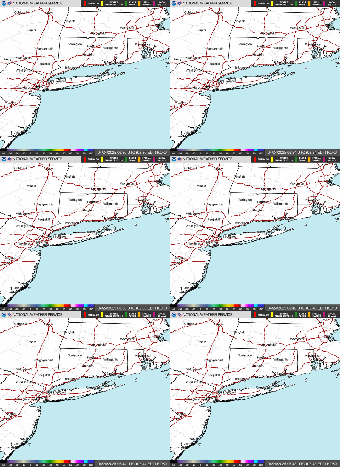
Live look at the weather radar as bands of rain, wind lash LI
Here's a look at current conditions from the National Weather Service.
East Hampton deputy supervisor: 'Brunt of the storm is upon us right now'
East Hampton Deputy Supervisor David Lys said there is “significant” flooding on the town’s bay-side coast, with water washing over docks. On the ocean side, water is scraping against dunes.
The Montauk Lighthouse, he said, has recorded wind gusts over 60 mph.
“Lots of trees are down, some power outages,” Lys said. “Overall, the brunt of the storm is upon us right now, and we will be evaluating as the day goes on.”
Lys said some areas on the north side of the town “are impassable.”

Freeport residents face flooding again
Freeport roads are under water again. NewsdayTV's Andrew Ehinger is there.

Nassau County's North Shore taking a hit
Parts of Nassau County's North Shore are dealing with heavy impacts from the storm.
Bayville Mayor Paul Rupp, in a text message, said Bayville Avenue was beginning to flood Saturday morning, adding that the inundation "presents a real risk."
Upper Brookville Mayor Eliot Conway said there were large trees down across Mill River Road earlier this morning that were cleared by a Department of Public Works crew. A tree leaning against wires on Willow Hollow Road is closed as PSEG workers handle repairs, Conway said in a text message.
Gov. Hochul: 'Stay out of the water'
Governor Kathy Hochul said the nor’easter is bringing heavy coastal flooding to Long Island, and the state expects waves as high as 20 feet to affect the coastline alongside severe wind gusts.
“That is strong, that is ferocious, and it needs to be taken seriously,” Hochul said in a press conference from the state’s emergency operations center in Albany.
Hochul said the state contacted Nassau and Suffolk Counties to coordinate storm response.
The storm is expected to drop 4-6 inches of rainfall over the next three days, Hochul said, but coastal flooding remains the main concern – with high-tide cycles bringing the worst inundation. A full moon tonight might also exacerbate flooding, Hochul said.
Coastal communities should prepare for power outages, as heavy wind is expected to continue to rip down trees and power lines.
“Here’s the bottom line: Stay out of the water,” Hochul said.
Waking up to a waterfall in East Patchogue
Teresa Rose, of East Patchogue, woke up shortly before 5 a.m. to prepare for her day shift as a nurse. She went into her kitchen and turned on her coffee machine when the sound of running water caught her attention.
A large oak tree, one of four clustered together, had fallen earlier in the night and crashed into an unoccupied spare bedroom on the corner of her home in the Patchogue Shores neighborhood. By 9:30 a.m., the roof in the bedroom was continuing to sink and water damage could be seen in the adjacent living room.
"I went to bed at midnight, checked, everything was good," said Rose. "We're always worried about the wind. It's just unfortunate, the nor'easter, the winds were out of the north."
A tree service company led by one her neighbors was already clearing the debris from the home early Saturday morning. Several other neighbors had stopped by to offer support, as well.
"This community is the best community to live in," she said, adding that she had offered space in front of her home for neighbors in a lower-lying area prone to flooding to park their cars.

NewsdayTV meteorologist Geoff Bansen: Another 24 hours of this
NewsdayTV meteorologist Geoff Bansen said Long Islanders should brace for persistent rain and wind through Saturday night as a nor’easter continues to slam Nassau and Suffolk Counties.
Bansen said it will take about another 24 hours before conditions start to improve on Long Island.
“The winds will die down about midday tomorrow into Sunday afternoon, but until then we’ve just got these rounds of rain,” Bansen said.
The storm is wobbling north but is forecast to shift toward the Jersey Shore, just south of Long Island, bringing “an extra push of water,” he said.
Those waves are expected to erode beaches.
Rainfall totals have surpassed one inch in Eastport, Commack and Blue Point, as of Saturday morning. Islip and Westhampton have both experienced 54 mph wind gusts and downed trees are causing road closures and outages.
“It’s just going to keep on keeping on right through the PM hours,” Bansen said. “It does look like the heaviest push of this storm might be tonight in terms of rainfall, but the winds might pick up as that band of torrential rain moves on through.”
Brookhaven supervisor: 'Significant flooding' already
Brookhaven Supervisor Dan Panico said he was about a quarter mile from the shore in Mastic Beach Saturday morning but couldn’t reach the coast due to "significant flooding” that has already accumulated.
“In Mastic Beach, Shirley, the Greater Moriches area, the water is already over the bulkheads,” Panico said in an interview.
The town’s highway department has reported around 80 downed trees, and there are around 2,500 homes without power, Panico said.
Davis Park, on Fire Island, “is getting pounded.”
“Those beaches are taking on a very angry ocean,” Panico said.

Babylon supervisor: 'Major impact' from Great South Bay flooding
Babylon Supervisor Rich Schaffer said flooding from the Great South Bay during today’s high-tide cycles is expected to bring “major impact,” with inundation 2-3 feet above normal.
“That’ll put water into the streets,” Schaffer told NewsdayTV. “It should not affect people in terms of flooding into their homes.”
The town advised residents to move their vehicles to higher elevations. Schaffer said he expects some of the town’s low-lying areas, like Lindenhurst, Copiague and parts of Amityville, to experience street flooding.
As of this morning, Schaffer said heavy winds have knocked down around 35 trees. That total is expected to increase, and power lines may get taken down by the storm, he said.

Warnings and restrictions at all MTA bridges
The MTA is placing warnings and restrictions across all of its bridges amid the nor’easter, according to the MTA website and a spokesperson who said the agency is banning “empty tractor-trailers and tandems” on all MTA bridges.
There are additional restrictions on the Bronx-Whitestone Bridge, Marine Parkway Bridge and Verrazzano-Narrows Bridge because of strong winds. Multiple forms of towing are prohibited on those bridges, including “piggyback, dual [and] multiple trailers,” according to the MTA website.
On the Verrazzano-Narrows Bridge, all trucks that aren’t prohibited have to use the bridge’s lower level.
Drivers should reduce their speed going across the Throgs Neck and Cross Bay bridges because of windy conditions, according to the agency.
The MTA has also shut down pedestrian walkways along the Cross Bay and Marine Parkway bridges because of strong winds.
'It's like a big sound.' Tree crashes through LIer's backyard into his house.
Kamrul Alam was jolted out of bed around 4:30 a.m. when a large tree from his neighbor’s property crashed through his backyard and landed on his Court Street home in West Babylon, damaging a roof he said was just replaced two years earlier.
“It's like a big sound,” he said. “We thought the roof is broken.”
No one in the home was injured, he said. He lives with his wife, and their three children, a 9-year-old and twin 4-year-olds.
“It's like we are hypnotized,” he said several hours after the incident as he assessed the damage in his yard.
He said police and fire crews responded and determined the house was safe to stay in and advised him to contact an insurance company for the tree removal.

LIRR service restored between Huntington and Port Jeff; Valley Stream and Long Beach still suspended
Port Jefferson Branch service has resumed between Huntington and Port Jefferson after crews removed a downed tree from the tracks east of Kings Park, according to the MTA. Long Beach Branch service is still suspended between Valley Stream and Long Beach due to flooding near Island Park. Check your LIRR train lines and service changes here.
On second thought ...
As the waters rise on Island Park roads, drivers are having to take detours.

Island Park among towns seeing flooding as nor'easter hits Long Island
NewsdayTV's Andrew Ehinger reports.

Police responding to trees, wires down and car crashes

A strong nor'easter toppled a tree on North Woods Road in North Babylon Saturday. Credit: Thomas Hengge
Suffolk police have received dozens of calls about storm damage since early this morning, including at least three trees falling through the roofs of homes, according to a department spokesperson.
The first call came in at 12:42 a.m. for a tree that fell and knocked down power lines in Dix Hills. The debris blocked all lanes on Daly Road near the intersection with Jericho Turnpike, which remained closed as of 7:15 a.m.
Suffolk police have received at least 36 additional calls since then. They range from a traffic light outage in Brightwaters, to a driver crashing into a downed tree on Canal Road in Port Jefferson Station and a possible brush fire caused by a downed wire in Setauket.
Trees fell through roofs in West Babylon, East Patchogue and Dix Hills, according to the Suffolk police spokesperson, who flagged those as some of the most serious incidents so far this morning.
Nassau County police have received about 10 storm-related calls since shortly before midnight, all of which were about downed wires, according to a spokesperson.
Nassau police also received about 15 reports of car crashes during that time frame. It wasn’t immediately clear if those were all related to the nor’easter.
Forecast: Flooding emerging as greatest threat this morning

Suffolk Avenue flooding at 7:15 a.m. today in Island Park. Credit: Michael A. Rupolo Sr.
Long Island will be in a “pretty serious situation” this morning as the risk for coastal flooding peaks, according to National Weather Service meteorologist Bill Goodman, who said flooding could reach three feet above ground in certain places.
Overnight, there was some moderate flooding with wind gusts reaching up to 55 miles per hour throughout Long Island. Goodman said the flooding expected this morning will be far more severe, describing it as a “different beast” driven by a combination of high tides and strong winds.
“Don’t go by what happened last night to gauge what’s going to happen this morning,” he said. “That was just the start of what’s to come today and Sunday ... The worst of it looks like it’s going to be this morning.”
Goodman expects most flooding to be about one-to-two feet above ground, but said three feet of flood water is possible in certain places.
He said the highest risk areas are along the Great South Bay, from about Long Beach to Lindenhurst. Places near the Peconic Bay, like parts of Riverhead and the South Fork, are also high-risk flood zones, he said.
“Everybody is going to see at least moderate flooding ... but those will be some of the areas that get hardest with coastal flooding this morning,” he said of the high-risk areas. “[It’s a] pretty serious situation — especially this morning.”
Goodman said there will also be “multiple rounds of moderate to locally major coastal flooding” during high tide periods on Saturday night, Sunday morning and Sunday night.
Total rainfall for the weekend is expected to be about four inches, but Goodman said that would happen gradually, so there is not a significant risk of flash floods. Wind gusts could reach as high as 60 miles per hour, specifically on the East End, Goodman said.
Goodman expects "significant" beach erosion throughout the weekend, and warned residents to stay away from the shoreline.
“There won’t be much beach. You don’t want to put yourself in a position where you put your life at risk,” he said.
Checking on the rails and the airports

Credit: MTA
The Long Island Rail Road is operating normally except for planned weekend work, according to the MTA website.
Area airports are reporting a few delays and cancellations this morning according to FlightAware and the FAA. That's expected to rise as the wind and rain lash the region.
Check the status of the LIRR here and airport delays and ground stops here.
See where the power outages are on LI

Credit: PSEG LI
PSEG LI is reporting more than 500 outages this morning affecting close to 16,000 customers. You can see where the outages and report a problem at the PSEG LI outage map here.
Enjoying the view
Joining the many surfers from far and wide at Long Beach were locals who said Friday night’s view was among the best they’ve seen in a while.
Whether barefoot or sporting sneakers and other shoes, they scurried back as foaming waters crashed over rocks and floated over the sand.
“Seeing nature at its most powerful, but being at a safe distance is awesome,” Sean Campbell, 45, of Long Beach, said. “ This time of year when the surfers come out, they all put on a show, whether they got crushed or they ride one out for glory. … You get to see the sun setting with the clouds and it looks amazing.”
In case that wasn’t enough for Campbell or the others gathered, about 6:35 p.m., a rainbow appeared to the east, complimenting the setting sun to the west. Even Kate Sheil, who said she “is here everyday,” had to stop and snap a pic with her cell phone.
“I usually come down to check the waves and see if I’m going to surf after work,” Sheil, 45, of Long Beach, said. Clearly not dressed for the ocean, she said: “I like smaller waves.”
Chasing waves as nor'easter approaches LI

Michael Sztorc, 30, of Brooklyn spent his day surfing in Long Beach. Credit: Nicholas Grasso
The first nor'easter of the fall season was cause for many wave chasers from across Long Island, the five boroughs of New York City and even New Jersey to call out sick from their jobs Friday and flock to Long Beach.
Others, including Thomas Galabraith, left work early.
“We got in the water about an hour and a half ago and it got better by the end of the day,” Galabraith, 22, of Lavallette, New Jersey, said. “The waves grew in size. The wind just got right on them.”
By 6:15 p.m. Michael Sztorc wrapped up his second two-hour stint on his board at Lincoln Beach along the city’s boardwalk. He said the indescribable feeling of entering “the tube,” or the curve of an overhanging wave, was worth potentially upsetting some of his real estate clients by canceling meetings.
“There’s been a lot of really good waves, a lot of really good surfers,” Sztorc, 30, of Brooklyn, said. “Everyone’s having a really good time because we haven’t had waves in a very long time. … this is pretty much as good as it gets.”
Monte Montenegro, who owns the Strictly Surf shop in Amagansett said he ventured to Long Beach in his camper earlier this
week to ride waves upwards of 10 feet.
“I’m waiting to see what happens tomorrow morning,” Montenegro, 47, of East Hampton, said. “ if that storm comes anywhere near the coast and the wind is not so heavy we’ll get good waves again.”
Rainbows before the storm
A brilliant sunset and rainbows appeared in the sky over Long Island ahead of an expected nor'easter.

Rainbow in Long Beach Credit: Kevin Byrne

Rainbow in Bayport Credit: Hank Winnicki

Rainbow in Bohemia Credit: Susan Yale
Storm may linger until Monday
Forecasters said they were watching the duration of the storm, which could linger into Monday.
The storm is expected to ease slightly Sunday, but could bring steady rain and winds still consistently at 25 mph, according to the weather service.
The rate of rainfall could be lighter, at less than a half inch per hour, but the duration could mean a total of six inches over three days, National Weather Service Meteorologist Dominick Ramunni said.
“The wind and coastal flooding could be most impactful Saturday, but we could end up with more rain on Sunday,” Ramunni said. “It will be windier Saturday and by Sunday afternoon, things will gradually start to lighten and weaken by Monday.”
Wind gusts of about 40 mph were expected to increase overnight Friday and ramp up more Saturday, which will be the height of the storm, said Ramunni.
The storm could bring ocean waves between 7 to 15 feet on Western Long Island, and between 15 to 22 feet tall on Eastern Long Island, where the twin forks are expected to be battered with winds possibly up to 60 mph, state officials and meteorologists said.
“The biggest hazard from this system, on top of the wind, is the coastal flooding,” Ramunni said. “It will be most significant with the morning high tide cycle Saturday and Sunday morning as well.”
Weather warnings for Long Island
With the nor'easter arriving within hours, the National Weather Service said Long Island is currently under a coastal flood warning until 6 p.m. Sunday, with minor to locally moderate flooding predicted.
It is also under a wind advisory until 6 a.m. Sunday, with sustained winds between 20 mph and 35 mph and gusts of 55 mph. Winds will be stronger for the East End.
A preview of what's to come?

Nassau police and utlities responded late Friday afternoon to a downed tree in Wantagh. Credit: Newsday/Tara Conry-Berghorn
Winds have yet to reach the 50-60 mph gusts predicted for the nor'easter's peak this weekend, but local officials have already expressed concern over foliage-heavy trees — such as this one in Wantagh — being more susceptible to toppling than the barren ones more common during winter storms.
'Some of us still have PTSD from Sandy'

Amitville Village Mayor Michael O'Neill, right, in July. Credit: Linda Rosier
In Amityville Village, the public works, fire and police departments have been prepping all week for the storm, said Mayor Mike O’Neill.
This includes oiling and gassing up chain saws because, while flooding is the Paramount concern, he said, most trees are still full of leaves and might come down more easily with high winds and saturated ground.
"They might cause property damage, they might take down power lines and if so, how long will the power be out?," O'Neill said. "Some of us still have PTSD from Sandy" when power was out for days and weeks in some areas.
The village expects flooding and has been clearing drains, O’Neill said, with a close watch on streets at the end of canals and Amityville Beach. The village has opened up all municipal lots until at least Monday for those looking for parking, he said.
In Lindenhurst Village, residents on streets prone to flooding have been advised to move their vehicles to the LIRR parking lots and Shore Road lot, Mayor Mike Lavorata said.
"There’s no major flooding issues just yet but the big concern is the full moon tide," Lavorata said.
Loss of electricity and gas mains are also concerns, he said. If needed, he said the village would set up shelters at the Rainbow Senior Center and the high school.
"In some respects, we’re treating it like Sandy because we don’t want to take any chances," he said. "But I get concerned when it’s just a regular rainstorm because I never know what to expect, especially south of Montauk."
Long Island's coastal communities gear up for powerful nor'easter

Smith Point beach as waves crash on the shore in Shirley, Friday, Sapt. 25, 2026 Credit: Newsday/Steve Pfost
Long Island's ability to withstand powerful storms will once again be tested as a strong nor'easter sweeps in from the Atlantic Ocean.
Local officials and storm experts said the Island is as ready as it will ever be after a relatively mild summer gave beaches and dunes time to recover from blizzards and nor'easters that have struck the region in recent years.
Still, the combined force of potential 55 mph wind gusts and high tides could cause substantial damage, they said.
Fueling up before the storm

Cars wait in line for gas at the Costco Wholesale in Holbrook as the nor'easter storm approaches. Credit: Joseph Sperber
For coastal areas, concerns of high-tide flooding but no evacuation plans yet

Suffolk County Executive Edward P. Romaine at a news conference earlier Friday. Credit: Newsday/Steve Pfost
Long Island officials said they would be closely watching the tides, including on Fire Island, where evacuations could come later if conditions worsen.
High tide is scheduled for 8 a.m. Saturday and again at 8 p.m. Just as critical, the county executives said Friday, are if the nor'easter allows the tides to recede at low tide, or if waves as high as 12 feet could wash ashore.
"That is a critical point because at high tide with a full moon, that is going to increase the possibility of flooding," Nassau County Executive Bruce Blakeman said.
"We are hoping that the first high tide will dissipate, but it depends on the wind direction and the coastal direction of the whether or not the winds are blowing in a certain direction or not. When they're blowing the ocean into the bay, that's when it's a big issue that could create major flooding."
Authorities said they would prepared for any high water rescues.
In case of evacuations, Nassau County Community College is prepared as an evacuation center. The old family court in Westbury is also offering shelter for the homeless or anyone in need of refuge from the storm, Blakeman said.
Suffolk County Executive Ed Romaine said officials are concerned about low-lying areas, including Center Moriches, Mastic Beach, Shirley, East Patchogue and Lindenhurst.
Officials were also closely watching Fire Island, which could be subject to evacuations. Ferry service was canceled for Friday and Saturday, according to the Fire Island Ferry.
"We have not ordered, but may consider ordering an evacuation of Fire Island, depending on the latest weather reports," Romaine said. "We anticipate ocean waves of eight to 12 feet, so that's significant and obviously much less in the bay and the sound."
"If you're on Fire Island, have a plan, because I'd leave now. Because once the storm starts, it's going to be very difficult to get to you, so secure your house on Fire Island. Plan on leaving if you live further east along the ocean."
NYS declares state of emergency ahead of nor'easter

Gov. Kathy Hochul declared a state of emergency Friday afternoon. Credit: Ed Quinn
Gov. Kathy Hochul said she's declared a state of emergency ahead of the powerful nor'easter that's expected to impact Long Island.
Hochul told 1010 WINS there are no current plans for mandatory evacuations but her administration will consider them if the weather poses a serious threat to human life.
Races halted at new Belmont Park
The first race kicks off at the reopening of Belmont Racetrack on Friday, Sept. 18, 2026 in Elmont. Credit: Newsday/Howard Schnapp
Due to the incoming nor’easter, the New York Racing Association canceled its live racing programs for Saturday and Sunday at the new Belmont Park, which reopened last Friday following a three-year, $555 million redevelopment.
Belmont Park will be closed to the public on Saturday and Sunday.
Fans who purchased tickets and prepaid parking directly through Ticketmaster, FEVO or the NYRA sales team are eligible for a refund or ticket credit, and ticket holders will be contacted by the NYRA sales team via email for additional info.
Tickets purchased through a third-party vendor are not eligible for refunds from NYRA, and those ticket holders must contact the original vendor directly.
NYRA said it received approval from the New York State Gaming Commission to conduct live racing on Wednesday and Oct. 7. Belmont Park now will feature live racing Wednesday through Sunday throughout October.
'Not a Superstorm Sandy,' but Long Beach urges residents to be alert
Long Beach City Council President Brendan Finn robocalled residents with a message to take the storm seriously.
"While this is not a Superstorm Sandy situation, we do ask that you take precautions as we will see impacts," Finn said in the robocall.
"High tides are expected to be four to six feet above normal during the storm. If you live in or near an area that frequently floods, you will experience moderate flooding this weekend. Please move your vehicle to higher ground and store important documents in a safe location."
Finn advised residents to be prepared for power outages and to bring in or secure outdoor items. City crews are on standby to respond to the storm. For emergencies call 911 but to reach the Long Beach police department for nonemergencies call 516-431-1800.
Storm stops SCPD auction, for now

Cars up for auction at the Suffolk County Police Department Impound Section in Westhampton last year. Credit: Barry Sloan
Bad news, motorheads:
The Suffolk County Police Department vehicle auction, scheduled for Saturday, has been postponed due to the nor’easter forecasted to hit Long Island.
But those cruising for a new set of wheels are in luck: A new date will be announced in the future, police said in a statement.
LI ferries canceled, bus riders should expect delays
The forthcoming nor’easter is causing changes to bus and ferry service on Long Island.
Nassau’s NICE Bus, in a statement, advised riders to expect delays and detours caused by flooded roads, downed trees and wires, and road closures.
"With dangerous road conditions from high winds, heavy rain and coastal or street flooding throughout this upcoming weekend, riders of NICE Bus should use the NICE Go Mobile app to check the status of their specific bus in real-time during and after the storm," NICE spokesman Mark Smith said.
Fire Island Ferries, the Cross Sound Ferry out of Orient, and the Bridgeport & Port Jefferson Ferry all announced that they were canceling all service beginning Friday evening and lasting through all of Saturday.
Yankees fans miffed by decision to move Sabathia ceremony

Former Yankees great CC Sabathia waves to fans after delivering a ceremonial first pitch before ALDS Game 3 against the Toronto Blue Jays at Yankee Stadium on Oct. 7, 2025. Credit: Kathleen Malone-Van Dyke
The impending nor’easter forced the Yankees to reschedule Saturday’s home game against the Orioles, and therefore CC Sabathia’s number retirement ceremony as well.
But many fans who had tickets to see Sabathia get his number retired are miffed by the alternative.
The Yankees announced Thursday evening that they moved Saturday’s scheduled 7:05 p.m. game to the first game of a single-admission doubleheader beginning at 4:05 p.m. Friday. They also moved the Sabathia festivities to before Friday’s first game.
The problem? Only tickets dated for Friday were valid for the doubleheader, and tickets to Saturday’s game were not. The Yankees announced Thursday that fans with paid tickets to Saturday’s game “may exchange them for tickets to a similar regular season game at Yankee Stadium (subject to availability) as described in the Yankees’ rain check policy.”
That threw a wrench into the plans of fans who bought Saturday’s tickets strictly to see Sabathia, such as Selden’s Desirae Ross, who bought Saturday’s tickets as a Father’s Day gift for her dad and her best friend and his dad. She said the situation is “very unfair and unfortunate.
“Now none of us are able to go,” she said. “It’s sad because he’s been looking forward for it. Don’t think how they handled it was very professional. They didn’t give a 24-hour notice and people should be allowed refunds.”
Read more here.
MTA seeks to limit LIRR suspensions

MTA personnel monitoring the storm Friday from headquarters. Credit: Newsday/Alfonso A. Castillo
The Metropolitan Transportation Authority does not expect the forthcoming storm will lead to service suspensions on the LIRR, but is taking measures to prevent trees from falling on its tracks, and low-lying train stations from being flooded.
MTA Chairman Janno Lieber and Long Island Rail Road President Rob Free gathered at the transit authority’s Lower Manhattan headquarters Friday to update the public on storm preparation measures, which will include deploying crews and equipment, such as chain saws, throughout the system to quickly respond to storm-related incidents.
"Right now, the wind is, by far, our biggest concern, especially after some downed power lines knocked out Main Line service on the Long Island Rail Road a few days ago," Lieber said, referring to Wednesday’s rush hour service suspension caused a pair of PSEG utility poles toppling over onto the LIRR’s tracks near Hicksville.
"We don't want to see any more mishaps or disruptions on the Long Island Rail Road or any other part of our system," Lieber said.
Free said railroad crews have been aggressively clearing away trees and brush near the LIRR’s property that could pose a threat if they fell onto tracks — a problem that could be more likely if the ground becomes saturated with water.
Free said he spoke Wednesday to PSEG President and Chief Operating Officer Scott Jennings, who assured him that the poles that fell on the LIRR’s tracks Wednesday have been replaced and that they, and other nearby poles, have been inspected and are secure. Free said PSEG will also have extra crews available this weekend for "quick responses."
Based on forecasts, LIRR officials "don’t feel it’s necessary" to suspend service ahead of the storm, Free said, as they did in advance of a powerful blizzard in February. If there were any service suspensions, Free said it’s more likely they would be in Eastern Suffolk, where the storm is expected to be more severe and where the LIRR runs fewer trains.
MTA crews are also preparing for the potential for flooding, particularly in low-lying areas, like the LIRR’s Island Park and Far Rockaway stations. Free said the LIRR will have water pumps, high-water monitors, and plumbers available to address any issues.
Freeport to offer free undercarriage car washes Sunday
Freeport Village, which typically sees flooding during significant storms, will offer free washes for vehicle undercarriages Sunday, after the nor'easter's expected passage.
The service will be offered at the fire department's Hose Company No. 3, at 375 S. Bayview Ave., to wash out any saltwater that floods in from the shore.
"We will have minor flooding," Freeport Mayor Robert Kennedy said Friday. "Our police department and fire department both have high water army vehicles in the event of flooding."
The Pirate Festival on the Nautical Mile, scheduled for Sunday, is still expected to go ahead, but that could change depending on the weather, Kennedy said.
The village has its own electric power utility, and linemen will be standing by in case of any outages, he said. The village is monitoring the situation and updating it to residents through robocalls, Facebook, its website and on cable Channel 1844.
Freeport uses a series of pumping stations and catch basins to pump out floodwaters. Kennedy said the village public works department has been checking those sites to make sure they are unobstructed.
"I would ask everyone to be sure they take any type of backyard furniture, coolers, containers — anything that could take off in the wind and go into the water — that it be secured," Kennedy said.
The village has suspended its parking restrictions on municipal parking lots so residents along the waterfront can move their vehicles farther inland.
"If anybody in the low-lying areas wants to park their car up north in a municipal parking lot, the regulations have been suspended," Kennedy said.
He also advised that boaters be sure their boats are secure and have charged batteries.
County execs pledge coordination, warn of 'more impactful' storm

Nassau County Executive Bruce Blakeman meets with officials ahead of the weekend storm. He and Suffolk County Executive Edward P. Romaine pledged coordination Friday. Credit: Newsday/Howard Schnapp
Nassau and Suffolk county leaders warned Friday of potential flooding and power outages resulting from this weekend’s nor’easter, which is expected to bring up to 5 inches of rain and wind gusts topping 50 mph.
"We are facing as serious storm. We expect rain to start at 5 p.m. and last until midday Sunday," Suffolk County Executive Edward P. Romaine said. "But it's not the [rain] as much as the wind that will create the problem. We expect wind gusts up to 50 miles an hour, maybe even higher, and that wind will topple wires and trees, and that's where the problem lies."
At a briefing at Suffolk's emergency management headquarters in Yaphank, Romaine and Nassau County Executive Bruce Blakeman each signed executive orders declaring emergencies in both counties and pledging to share information and assets.
"Ed and I have taken a regional approach to every major issue that affects Long Island, and certainly when we're in a situation like this, an emergency situation, we work together and we share assets and information," Blakeman said.
"This storm is going to be more impactful than originally thought," he continued. "This is going to be what they call on the higher end of a nor'easter, it'll slowly strengthen. It's going to start early evening tonight, and it will continue on until Sunday."
Romaine noted that Suffolk is also facing "massive erosion" on ocean beaches, such as at Smith Point County Park, where officials were watching low tide creep up to the steps off the boardwalk.
"There's some steps down to the beach. No more beach. You step into the ocean, and the storm hasn't be truly begun," Romaine said. "We are very concerned about the impact of the storm, and what we would urge everyone to do is, if you don't have to go out during the heavy rainfall, don't go out. If your street floods, don't drive through flooded areas."
The view from Freeport

Strong winds were already testing tree tops outside Captain Ben's Fish Market in Freeport Friday afternoon. Credit: Debbie Egan-Chin
Nassau, Suffolk postpone all Saturday HS sports
With a nor’easter expected to bring heavy winds and rain this weekend, all high school sports events on Saturday have been postponed.
The Massapequa-Garden City showdown of football unbeatens has been rescheduled for Monday at 5 p.m. at Hofstra's Shuart Stadium. Garden City has the longest win streak in the country at 68 games. And Massapequa has won 25 games in a row.
“We follow the recommendation of the county office,” said Pat Pizzarelli, the executive director for Section VIII, which governs all interscholastic schools. “Our main priority and responsibility are the safety of our athletes.”
Nassau County Executive Bruce Blakeman and Suffolk County Executive Edward P. Romaine called an early afternoon news conference and recommended no travel for Saturday and Sunday.
“We are shutting down all athletic contests countywide,” said Tom Combs, the executive director for Section XI. “We are following the advice of our superintendents, executive board of directors and the emergency notifications from Suffolk County. It’s clear that this can turn into a very dangerous situation. This decision keeps our bus drivers and all people driving to games off potentially hazardous roads and safe. It also places the safety of our coaches and student-athletes as our top priority.”
There are no school sports scheduled for Sunday.
“Sunday is not an option for makeup games,” Combs said. “There are 13 varsity football games postponed on Saturday. They will be played on Monday.”
Read more about the postponements here.
Ducks move up Atlantic League title game due to storm
The Long Island Ducks announced on X Friday that tonight's Championship Series game against the Southern Maryland Blue Crabs has been moved up to get ahead of the pending nor'easter. Gates are now set to open at Fairfield Properties Ballpark in Central Islip at 5 p.m. The game, originally set to start at 6:35 p.m., will now start at 5:30 p.m.
🚨 CHAMPIONSHIP GAME 3 UPDATE 🚨
— Long Island Ducks (@LIDucks) September 25, 2026
Tonight’s first pitch is now scheduled for 5:30 PM, with gates opening at 5:00 PM.
Stay tuned for further updates. pic.twitter.com/P6tIPdBPCD
Nor'easter already impacting Long Island

Ahead of storm, enable smartphone emergency alerts, state says
New York State officials are urging residents to enable government emergency alerts on their mobile phones and sign up for real-time weather and emergency alerts by texting their county or borough name to 333111.
"With a significant coastal storm starting to impact New York State, we are actively monitoring the track of the storm and any potential impacts," Gov. Kathy Hochul said in a statement Friday, adding: "I urge New Yorkers to stay informed, stay prepared, and closely monitor local weather updates as conditions develop over the weekend."
The governor’s office also said that due to high winds, MTA Bridges and Tunnels is implementing a ban on empty tractor-trailers and tandem trucks beginning Saturday at 12:01 a.m. until 2 a.m. Sunday. Pedestrian walkways on bridges may also be closed if high winds are forecast.
Officials are also urging residents with air travel plans to check with their airlines or consult tracking services regarding potential airport delays.
The state Office of Emergency Management (OEM) is prepared to deploy emergency response assets and supplies as needed, officials said. The governor’s office also said the State Watch Center, New York’s 24/7 alert and warning hub, is monitoring the storm track and statewide impacts closely.
Currently, there are 5,675 workers available statewide to support response, restoration and repairs. This includes 175 overhead mutual aid contractors secured by Con Edison. "Cut and toss" crews have also been pre-staged to support debris clearance from possible downed trees.
Save these emergency contacts ahead of the storm

A downed tree at the intersection of Old Dock and Upper Dock roads in Kings Park in 2025. Credit: Rick Kopstein
The nor'easter headed toward Long Island has the potential to cause heavy coastal flooding and wind damage, including bringing down power lines and trees.
It's important to be prepared, including having all the important contact information at your fingertips.
Here's a guide to how to report power outages and downed trees, along with contacts for each county, town and city on Long Island, and key transit agencies.
See what weekend events are canceled or postponed
The Greenport Maritime Festival has been rescheduled. Credit: Elizabeth Sagarin
Organizers behind many events scheduled for Saturday and Sunday are canceling, postponing or rescheduling their events, including the Greenport Maritime Festival, the Long Island Potato Festival and the Hamptons Marathon, while others are still monitoring the weather before making decisions. Check the status of these and other events.
Strong winds up to 55 mph, coastal flooding expected to start today

A surfer takes advantage of the waves at Lido Beach on Thursday as a nor'easter approaches Long Island. Credit: Newsday/J. Conrad Williams Jr.
After days of debate about potential storm tracks, the National Weather Service is now certain an early-season nor'easter will impact Long Island this weekend, with strong winds and localized storm surge-related coastal flooding beginning Friday — and "a prolonged period of rainfall" expected to follow and continue straight through to Monday.
As much as 5 inches of rain could blanket Long Island, forecasters said, adding that wind gusts as high as 55 mph are expected Friday, and that the strength and duration of the system will likely cause the downing of tree limbs and power lines. Learn more about the latest forecast.
Lead pipe problem in Nassau ... Poll: LIers want more affordable single-family homes ... Pension costs spike on LI ... What's the weather forecast
